Maghasberd — a Bagratiid fortress near Ani

Magazberd: An Armenian Fortress on the Turkish Side of the Araks

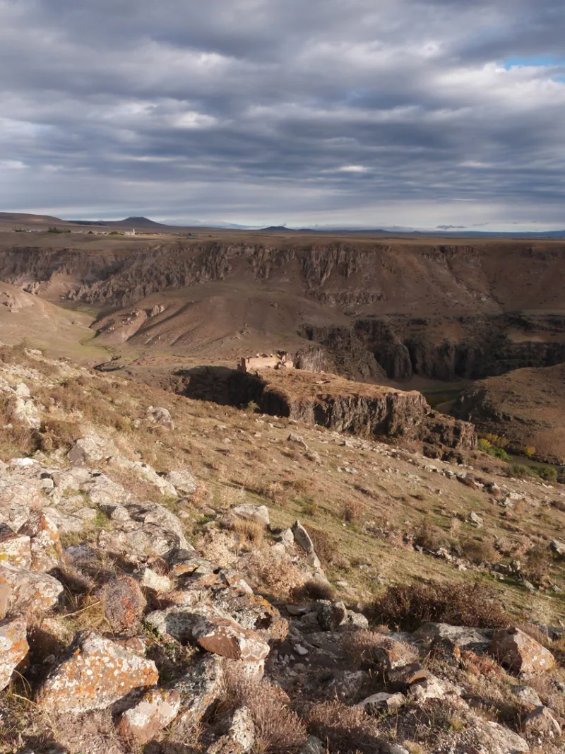
Six kilometers southwest of the great city of Ani, on the right bank of the Arpaçay River (ancient Akhurian), stands the little-known but historically significant fortress of Magazberd (Maghasberd). This border stronghold was built on tuff cliffs during the heyday of Bagratid Armenia and later passed to the Seljuks, the Georgians, the Khatunogullars, and finally to the Ottomans. Today, Magazberd is a restricted military zone right on the border with modern-day Armenia, and gaining access to its territory is practically impossible. But even from a distance, it makes a strong impression.

History of the Fortress

The possible origins of the fortifications on this rock date back to the 6th century, though the surviving structure largely belongs to the era of the Bagratid Kingdom of Armenia (885–1045). The fortress’s strategic importance rose sharply after Ani became the capital of the Armenian Kingdom in 961: Magazberd covered its southwestern approaches and controlled the crossing through the Arpachay Canyon.

After the fall of the Bagratids, the fortress changed hands between the Seljuks, the Kingdom of Georgia, and the Turkic Hatunogullari dynasty. In 1579, Magazberd was captured by the Ottoman Empire and rebuilt. An inscription on the northern gate attests to this: the reconstruction took place under Sultan Murad III. An Ottoman garrison held the fortress until the mid-19th century, after which it was abandoned and fell into ruin.

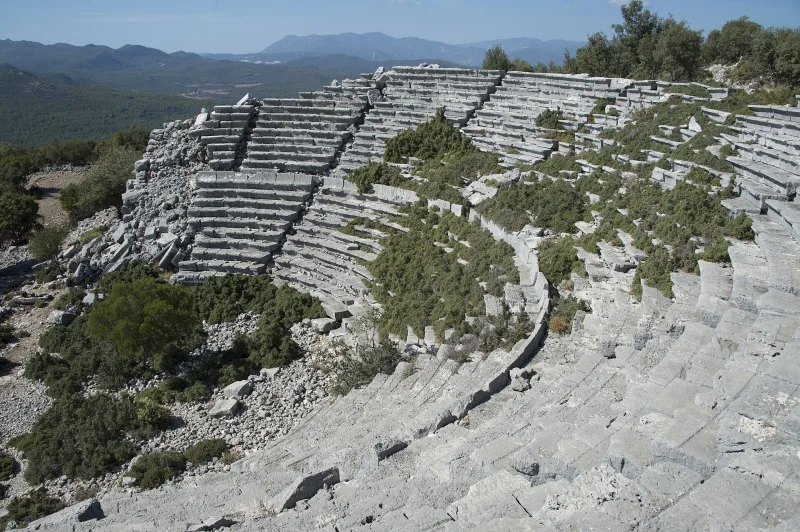
Modern archaeological work began in 2004–2005: excavations revealed the remains of “Old Magazberd”—an entire city quarter located approximately 100 meters above the river, featuring a city wall, cylindrical, rectangular, and horseshoe-shaped towers, and the ruins of churches. This led to the conclusion that the fortress was not merely a garrison area, but a fully-fledged fortified city.

Architecture and What to See

Walls and three large towers

The structure is built of tuff—a light-colored volcanic rock characteristic of the region, warm in the sun and resistant to weathering. The foundation of the fortification consists of three large towers, which have largely survived to this day. The curtain walls between them are partially destroyed, but the outline is clearly visible.

Ottoman inscription on the northern gate

An inscription from 1579 remains at the northern entrance, recording repairs carried out during the reign of Sultan Murad III. This is a rare instance where Ottoman epigraphy is clearly integrated into an earlier Armenian structure.

Internal structures

Inside the fortress perimeter, the remains of stone residential buildings, several chapels, a palace, a bathhouse, and a large square cistern are visible. This complex confirms that Magazberd functioned not only as a military outpost but also as a small princely center.

Old Magazberd

Discovered in the mid-2000s, “Old Magazberd” is a separate fortified quarter on a rocky terrace. Its walls feature various types of towers (cylindrical, rectangular, horseshoe-shaped), and the remains of churches have been found in the masonry. This is a rare example of an Armenian border town from the 10th–11th centuries on the territory of modern-day Turkey.

Interesting facts

  • Magazberd is located virtually on the border with the Republic of Armenia and falls within the first border zone: tourist access to the ruins themselves is closed.
  • It has survived better than some of the structures in Ani itself: Magazberd’s tuff towers remain almost entirely intact to this day.
  • The fortress survived the reigns of the Bagratids, Seljuks, Georgians, Khatunogullars, and Ottomans—a rare combination for a single monument.
  • The discovery of “Old Magazberd” in the 2000s changed perceptions of the fortress: it turned out to be a small fortified town rather than a separate fort.
  • The nearest settlement to the ruins is the Kurdish village of Üçbölük; it serves as a landmark on topographic maps.

How to get there

The fortress is located in Kars Province, near the village of Üçbölük, southwest of the ruins of Ani. Coordinates: 40°28′31″ N, 43°32′30″ E. The nearest major city is Kars (about 50 km), and the nearest airport is Kars Harakani (KSY).

It is generally not possible to drive up to the ruins themselves: the entire strip along the Arpachay River is part of a restricted military zone near the border with Armenia. Permits to visit must be obtained separately and are rarely issued to tourists. In practice, most travelers are limited to viewing Magazberd from distant points along the road from Ani toward Üçbölük or from the Ani Plateau itself across the canyon.

Tips for travelers

The main advice is to manage your expectations realistically. You will almost certainly not be able to enter the fortress itself: this is a border zone, and attempting to approach without permission risks trouble with the military. Bring binoculars or a telephoto lens—and treat Magazberd as part of the Ani landscape, its “distant outpost.”

The best time to visit is late spring and early fall. In winter, the plateau below Ani is swept by icy winds, and temperatures drop well below freezing; in summer, days can be hot, but evenings are cool. Fall offers the best light for the tuff and the Arpachay Canyon.

Do not photograph military installations, antennas, or border guards. If your goal is to understand the context of Magazberd, be sure to combine your visit with a walk through the ruins of Ani themselves: only then will you get the full picture of the Armenian capital and its defensive belt.

From Kars, it’s easy to plan a day trip: Kars Kalesi (the city fortress and the Cathedral) in the morning, Ani after lunch, and a scenic stop on the way toward Magazberd. A day like this requires a car: there is virtually no public transportation to this border zone.

Your comfort is important to us, click on the desired marker to create a route.
Meeting for minutes before
Yesterday. 17:48
Frequently asked questions — Maghasberd — a Bagratiid fortress near Ani Answers to frequently asked questions about Maghasberd — a Bagratiid fortress near Ani. Information about the service's operation, capabilities, and use.
Magazberd (Maghasberd) is a medieval fortress located on the right bank of the Arpaçay River in Kars Province, 6 km southwest of the ruins of Ani. It was built during the heyday of the Bagratid Kingdom of Armenia and guarded the southwestern approaches to the capital of Ani, controlling the crossing over the Arpaçay Canyon. Throughout its history, the fortress served as an important strategic stronghold for over a thousand years.
Magazberd has passed through the hands of several rulers: initially, presumably in the 6th century, then the Bagratid Kingdom of Armenia (885–1045), followed by the Seljuks, the Kingdom of Georgia, the Turkic Hatunogullari dynasty, and finally the Ottoman Empire, which captured the fortress in 1579. This is a rare combination of cultural layers for a single monument.
“Old Magazberd” is a separate fortified quarter discovered by archaeologists in 2004–2005, located approximately 100 meters above the river. It has its own city walls with various types of towers (cylindrical, rectangular, and horseshoe-shaped) and the remains of churches. Its discovery changed perceptions of the site: it turned out that Magazberd was not merely a garrison fort, but a small fortified town from the 10th–11th centuries.
The inscription dates from 1579 and records the restoration of the fortress during the reign of Sultan Murad III. This is a rare example of Ottoman epigraphy clearly integrated into an earlier Armenian architectural structure, vividly illustrating the layered history of the site.
Three large tuff towers have survived, along with the partially intact curtain walls between them and the internal structures: the remains of residential buildings, several chapels, a palace, a bathhouse, and a large square cistern. The tuff towers stand almost entirely intact—unlike some of the structures at Ani itself—making Magazberd a surprisingly well-preserved monument.
Virtually none. Magazberd is located in the first border zone along the border with the Republic of Armenia and is a restricted military area. Permits to visit are issued extremely rarely and require a separate application through official channels. Most travelers view the fortress from a safe distance—from the road or from the Ani Plateau across the canyon.
The entire strip of land along the Arpaçay River is part of a restricted military zone. Attempting to enter the area without special permission may result in detention by military personnel. You must strictly adhere to the designated observation points and refrain from photographing military installations, antennas, and border guards.
The best time to visit is late spring (May–June) and early fall (September–October). In the fall, the light on the tuff formations and Arpaachie Canyon is particularly beautiful. In winter, the plateau is swept by icy winds and temperatures drop well below freezing, making for an uncomfortable trip. In summer, it can get hot during the day, but evenings are cool.
There is virtually no public transportation in this border area. You will need your own car or a rental car to get there. The nearest major city is Kars (about 50 km away), which is a good starting point for planning your route.
Magazberd served as an outpost for Ani—the medieval Armenian capital, located 6 km to the northeast. After Ani became the capital of the Bagratid Kingdom in 961, Magazberd protected its southwestern approaches. Today, the fortress is viewed as part of Ani’s defensive perimeter and is best appreciated in conjunction with a visit to Ani itself.
Tuff is a light-colored volcanic rock characteristic of the Kars region. It is resistant to weathering, retains its shape well, and does not deteriorate as quickly as limestone. It is precisely because of the tuff that the Magazberd towers have survived in much better condition than one might expect from an abandoned site.
A convenient one-day itinerary from Kars: in the morning—Kars Kalesi (the city fortress) and the Cathedral; after lunch—the ruins of Ani with a detailed tour; on the way back—a scenic stop near Magazberd, on the side of the village of Üçbölük. This itinerary provides a comprehensive overview of the region’s Armenian architecture and history.
User manual — Maghasberd — a Bagratiid fortress near Ani Maghasberd — a Bagratiid fortress near Ani User Guide with a description of the main functions, features, and principles of use.
Kars is the nearest major city to Magazberd (about 50 km away) and is home to Kars Harakani Airport (KSY). It offers a range of hotels, cafes, and car rental agencies. Kars is the most convenient starting point for a day trip to Ani and the Magazberd viewpoints.
There is virtually no public transportation to the Ani border area and the village of Üçbölük. Be sure to rent a car in Kars in advance, especially during the tourist season (spring and fall). Check with the rental company to see if the insurance covers trips to the border area.
Magazberd is located in the first border zone along the border with Armenia. Entry into the fortress is prohibited without special permission. Check in advance whether you can obtain a pass through local authorities or travel agencies in Kars—in practice, permits are issued extremely rarely. Plan your trip realistically as a sightseeing tour rather than an entry into the fortress.
Since you won’t be able to get right up close to the fortress, binoculars or a camera with a telephoto lens are essential. The Magazberd towers are clearly visible from the Ani Plateau through the Arpachay Canyon or from the road leading toward Üçbölük. The best light for photographing the tuff walls is in the morning and evening, especially in the fall.
Before heading out to explore the viewpoints at Magazberd, spend a few hours walking through the ruins of Ani. It is here that you’ll truly grasp what Magazberd was meant to protect: you can see the logic behind the defensive belt, the Arpachay Canyon, and the border with Armenia. On a clear day, Magazberd is visible to the naked eye from the Ani Plateau.
After passing Ani, follow the road toward the village of Üçbölük—it serves as a landmark on maps for the Magazberd region. Along the way, there are open areas from which you can see the fortress across the canyon. Stop only in designated areas, do not enter fenced-off military zones, and do not photograph border infrastructure.
Do not attempt to cross the fences or go down to the Arpaçay River on your own without an escort or permission. Do not photograph antennas, military posts, or border guards. If you encounter a military patrol, remain calm and explain that you are a tourist exploring the Ani area. Carry your passport with you—documents are checked regularly in border zones.